Tuesday, November 3, 2009

Salt Fork River Flood Plain


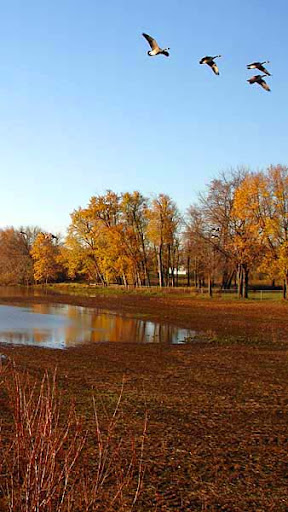
The river is finally back in its banks after the recent one inch of rain we had here in Homer/Saint Joseph area. However, the flooding has left numerous potholes in the flood plain. This one was full of Canadian geese early this morning. My slow reaction photo missed most of them but I did manage to capture a few. The river is still quite high and quick moving but by the weekend it should be great for a kayaking trip. Note also that the trees are still showing some color and the field had been harvested before the flooding.

Thursday, October 15, 2009

Blog Action Day - Climate Change

Today is Blog Action Day. Blogs all over the world and of all types are sharing a common topic, Climate Change. There is no doubt that the world’s climate is changing and that in the next 50 years the Salt Fork River will be changed by this.

Climate change will affect the water temperature, the flow rate, the vegetation, life in the river and life along the river. What a change this will be for the Salt Fork River and the region. One encouraging fact that I have been reading is that healthy and intact river basins, wetlands and floodplains are less vulnerable to climate change.

So Salt Fork Friends, I would like to encourage you to educate yourselves selves about the River, about its environment, its wetlands and floodplains. Then, do what you can to ensure that these areas are healthy and intact. If many people are personally involved in initiating projects to promote and establish a healthy river corridor, the Salt Fork stands a much better chance of surviving and adapting to future climate changes. Homeowners and landowners especially need to be more intentional about establishing and nurturing these areas, some of which are in their own back yards. Don’t wait for your neighbor to do this; don’t wait for the government to do this. Educate yourself about rivers and climate change, decide what YOU can do for the future of the Salt Fork River and its watershed, and then do it!

Monday, September 7, 2009

Crayfish

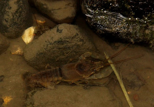
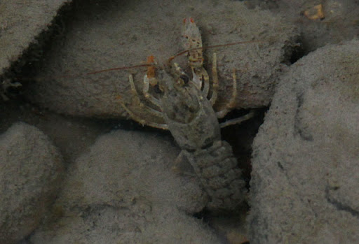
On Saturday, we went wading around the ford across the Salt Fork, about one quarter mile upstream (as the crow flies) from the bridge on 1200N at the south edge of Homer Lake Park. We were looking for mussels, and although we didn't find any live ones, we did find these guys, a large one (top, about 2.5-3.0 inches), and a small one (bottom, maybe 1.5 inches) about 10 feet upstream.

We have no experience identifying crayfish (among other things), so if you have any specific knowledge, please add comments. Rob Kanter has a nice post on Appeciating Illinois Crayfish at the Environmental Almanac blog, and the Carnegie Museum of Natural History maintains an extensive database, including information and many photos of Illinois speciescrayfishcrayfish

Tuesday, August 18, 2009

Another Friend

The Salt Fork River just got another friend: Carle Foundation Hospital. Carle Foundation hospital and Carle RxExpress are opening free medical-waste disposal sites that will be open all year. This is a new program called "Healthy People, Happy Planet," which provides safe disposal practices for expired and unwanted medications and used needles. Previously, the only local year-round option available was to dispose of these items in the trash and, in the case of medications, many ended up being flushed into the sewage system. Well, no more. Starting August 29th there will be drop boxes for medication disposals at RxExpress locations.

There is such a vast amount of trash, both seen and unseen, that ends up in the Salt Fork River. Kudos to Carle for this new service which facilitates decisions by each of us that can provide cleaner water in east central Illinois.

Thursday, August 13, 2009

August Observations


Friday, August 7th, 2009

From private land upstream of 2500E to 2700E (county line road)


One of my daughter’s first requests after being abroad in Kazakhstan for almost a year was to take a trip down the Salt Fork. We put in at a friend’s place in our kayaks to enjoy a leisurely float with our old friend, the river. I found it interesting that this would be one of her first requests. My husband was raised on a farm along the Salt Fork and our kids grew up here, too. As the transplant from the suburbs of Chicago who fished with my Dad on vacations and took excursions to the Boundary Waters and Quetico, it was easy for me to fall in love with this river 30 years ago when I married and called this place my home, too. And now that our children are grown they are drawn back to the Salt Fork when they come home. Since our kids were toddlers we took them along on trips down the Salt Fork. Sometimes my husband would fish, sometimes the kids would try to catch bugs in their dip nets, and as they got older their friends would come along and they would play in the river as much as float along in the boat. Eventually they took the waters on their own.


As Rachel and I paddled along on Friday, she reminisced about when she and her best friend dumped their trash-laden canoe during one of the fall river clean-ups almost ten years ago. As a parent, you sometimes wonder if you are doing the right things for your kids and it isn’t until they are grown that you can begin to see some of the fruits of your labors. I know for certain that one thing we did do right was to expose our kids to the beauty and enjoyment of the Salt Fork River. We were able to instill in them a sense of natural beauty, sensitivity to environmental issues and responding in positive ways, the idea that neighborhoods are not just around city blocks, trash in the river (and everywhere) is ugly, enjoying the outdoors is not just a summer sport, and the idea that everybody lives downstream.


With that said, here are a few comments from our recent trip. One of our first observations was to notice cut logs in a pile of woody debris before coming to the bridge at 2500E. It appears that someone has taken the time to go down to the river with a chainsaw to cut the fallen trees into 6-8 foot sections in an effort to prevent a build-up of woody material along their property. Logjams, as they are sometimes called, are a controversial issue along the Salt Fork with drainage, recreation, habitat, and erosion being some of the topics that get debated. In this particular instance, the landowner or whoever cut the logs used a good method, using low-impact access and tools to reduce the size of the trees so they would likely be carried away in the next flood. I am encouraged by the practice and hope to see more of this type of channel maintenance in the future.


We found graffiti on the 2500E bridge piling, native hibiscus (Hibiscus palustris) in bloom at the outlet of the Homer Lake spillway runoff, and caterpillars dangling from silken threads over the middle of the channel. But mostly, we just found a peaceful place to enjoy the day. And what better way to come back to the USA than to chill in a kayak and ponder life. In our busy world we desperately need places to find a little solitude and rest and the Salt Fork River is one of them. I am so grateful it is nearby and that my kids have found enjoyment there, too.


Posted by Suzanne Smith


Saturday, July 18, 2009

Salt Fork muses - July 4, 2009

On July 4th, six of us took to the river at the Chainy Ford bridge (700E) on a drizzly morning including Lex, Joan, Jim, Eleanor, Tom and myself. With optimism, we headed out expecting the light rain to taper off into sunshine by late afternoon.
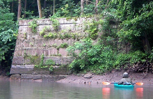
About two miles into the trip we passed massive sandstone blocks that formed the bridge abutments for the C & EI (Chicago and Eastern Illinois) Railroad. The bridge and tracks are gone now, but the stones were alive with plants and animals. Upon closer examination, wolf spiders could be seen in the crevasses, centipedes clustered on the green mats of moss, and up near the top we discovered white-flowered shrubs that we later keyed out to be the native hydrangea Hydrangea arborescens. I was unaware that there was a native hydrangea in our area! Later in the day we found many of these plants along the banks, especially in the shale outcroppings where the broad, white flowers cascaded down the bank. Patches of green water willow Justicia americana could be seen growing well along the banks and in the sand and gravel bars throughout this stretch of stream and a number of hibiscus plants Hibiscus palustris were spotted along the banks that will bloom later in August.
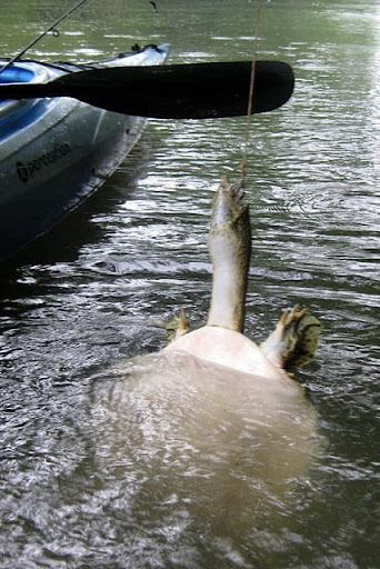
Tom and Jim tried their luck at fishing but caught only a few smallmouth bass Micropterus dolomieui. At one site trotlines lay baited across our path. Tom noticed a bobbing line and discovered a large soft-shelled turtle with dark green spots caught on the hook. Looking it up in the Field Guide to Amphibians and Reptiles of Illinois later, we discovered it was a spiny soft-shelled turtle Apolone spinifera.

The river was not as clear as we had hoped. It was surprising at times to see the yellow mud line in the stream where the muddy sediment draining out of a gully met the stream channel waters.
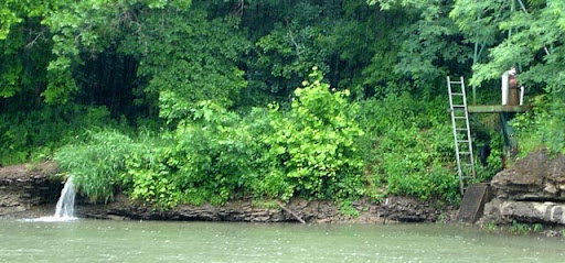
After four miles we took a lunch break underneath the Rock Ford bridge at County Highway 10-850E where we contemplated the weather, the Oakwood sanitary district and their downstream water intake for drinking water, and the 6-mile journey ahead. Unable to get any phone service in the river valley to request Jake’s shuttle service, we decided to paddle on.

Periodically someone would say, “Hey, I think it’s getting light in the west!” but alas, it was not to be, so we watched the kingfishers and great blue herons instead and pondered dry clothes and warm homes. Jim was unable to locate the heron rookery but he did notice two old coal mine pilings along the way reminding him of a time gone by when strip mining was common in this area. Even though most of the birds were quiet in the rain, Jim and Eleanor did spot a bright yellow prothonatary warbler Protonitaria citrea and they heard the call of the summer tanager Piraga rubra.
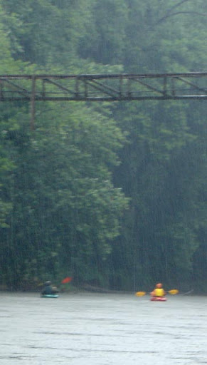
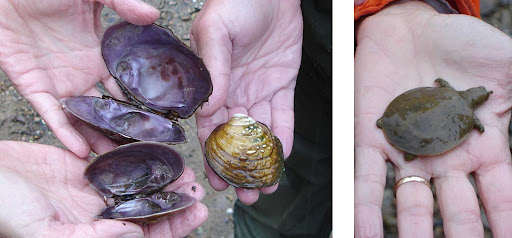
The gentle hush of the rain as misty clouds drifted overhead in the canopy created a tranquil setting as we explored the lower reaches of the Salt Fork. Unlike the Champaign County portion, this reach contains more riffles and bedrock ledges as the Salt Fork cuts downward toward sea level providing “wheee” moments as we shot the chutes in our kayaks! Interesting shale outcroppings became common as we paddled further downstream exposing large glacial boulders and coal seams. Perhaps due to the gentle rain, mini rock falls occurred periodically along the way and the stones came alive with colors and patterns as we explored the gravel bars. Crinoid fossils and Indian paint pots were there along with relic and fresh mussel shells including specimens of the state threatened purple wartyback Quadrula pustulosa. To our delight, near the sandy shore, Lex found a live specimen of this beautiful rare mussel plus a very small soft-shelled turtle that was fresh but quite still. Had it just emerged from its shell or was it dead? As a wise prophet once said, “What we don’t know could fill the Grand Canyon” and I, for one, am beginning to think maybe he might be right.By the end of the trip at the confluence of the Middle Fork, we were all soggy and chilled, ready for a warm, dry home and some hot chocolate. But we all agreed it is a beautiful and interesting stretch of stream that should be revisited at a drier, warmer time, perhaps this fall. To put in at the Oakwood bridge and just enjoy the gravel bars along the way would be a trip in itself, and when the river is clear it would be wonderful to look for mussels again. What a treasure to have this river in our backyards.

Suzanne Smith